I sat in on a project meeting a while back where a superintendent pulled up a spreadsheet to answer a simple question. The owner wanted to know how much concrete had actually been poured that week. It took him almost ten minutes of scrolling and cross-checking against a handwritten daily log before he had an answer, and even then he hedged it with “roughly.” That’s not a knock on him. That’s just what progress tracking looked like on most job sites for decades. Somebody walks the site, somebody writes things down, and everybody downstream trusts that the notes were accurate and complete.
If you want the fuller picture of how any of this works in practice, this drone construction guide walks through it in more depth.
Drone-based site scanning has quietly changed that math, and the shift is bigger than most people outside the industry realize.
Manual Walkthrough vs. Drone Site Scanning: How Do the Numbers Compare?
| Factor | Manual Walkthrough | Drone Site Scanning |
|---|---|---|
| Time to capture a mid-size site | 3-4 hours | 12-15 minutes |
| Crew required | 1-2 people | 1 pilot |
| Data type | Visual estimate, written notes | Measurable 3D model and orthomosaic |
| Measurement accuracy | Rough estimate, often ±10-15% | Within a few inches, sometimes tighter |
| Realistic flight/visit frequency | Weekly at most, often less | Weekly, daily during critical phases |
| Record for later disputes | Photos and notes only | Re-measurable model, timestamped |
| Typical dispute resolution time | Days to weeks | Often a single meeting |
| Change order cost exposure | 5-10% of project value at risk | Meaningfully reduced with clear records |
The gap isn’t just speed. It’s that every column on the drone side produces something you can go back and check later, while most of the manual side depends on memory and judgment calls made in the moment.
Why Was the Old Way Never Really Precise?
Here’s a number worth sitting with. Depending on the study you look at, somewhere between 70 and 90 percent of construction projects run over their original schedule. Some of that comes down to weather, permitting, and supply chains, things nobody can fully control. But a good chunk of it comes down to something a lot easier to fix. Nobody actually knew, in real time, how far along the project was.
Progress tracking, traditionally, meant somebody walking the site every week or so, sometimes less often on bigger jobs. A superintendent or project manager would walk it with a clipboard or a tablet, eyeball how much had changed since the last visit, and turn that into a percentage complete for the report. If a site covers 40 acres, that walk alone can eat up half a day, and even then it’s one person’s judgment call on how “done” something looks.
The problem isn’t that people were bad at their jobs. The problem is that eyeballing progress across a 40-acre site, or even a 4-acre one, just isn’t a precise measurement. It’s an estimate dressed up as a number.
What Actually Changes When a Drone Does the Walk Instead?
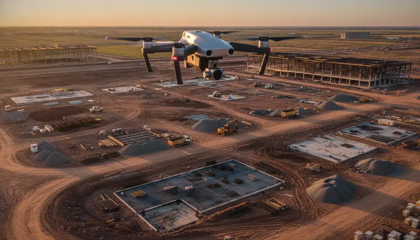
A drone can cover a site that would take a person 3 to 4 hours to walk in about 12 to 15 minutes. That’s not a minor efficiency bump. It’s a different order of magnitude altogether. And it’s not just faster, it’s also more complete. Every square foot gets captured in the same flight, at the same time, under the same conditions. Nothing gets skipped because someone got tired or ran out of daylight.
Once that flight data gets processed, usually within the same day, it turns into an orthomosaic map and often a 3D model of the entire site. From there, someone can measure exactly how many cubic yards of earth got moved that week, how much of a foundation has actually been poured versus formed, or how many linear feet of utility trenching is complete. Not “about 60 percent,” an actual number pulled from actual geometry.
I’ve seen contractors run this on a two-week cadence and use the resulting data to catch a grading discrepancy that was off by almost 8 inches across one corner of a site, something that would have gone unnoticed by eye until it caused a real problem with drainage later on. That’s the kind of catch that’s worth more than the cost of the flight many times over.
What Does This Actually Save in Money?
Change orders are usually where this shows up most clearly on a balance sheet. Industry estimates put the average cost of construction change orders somewhere around 5 to 10 percent of total project value, and a good chunk of those come from disputes over what work was actually completed by a certain date, or disagreements about scope that could have been settled with better documentation.
When there’s a weekly (or even daily) record of exactly what existed on site, with timestamps and measurable data attached, a lot of those disputes just don’t happen in the first place. There’s nothing to argue about when both sides can pull up the same 3D model from the same date.
Think about the labor side too. A two-person survey crew doing manual measurements on a mid-size commercial site might burn a full day, sometimes two, on data a drone wraps up in under 20 minutes and processes by the next morning. Multiply that gap out at a blended labor rate across a project running 12 to 18 months, and it adds up faster than people expect.
How Does This Actually Get Used Week to Week?
It usually starts with a baseline flight before any real work has begun. That first flight becomes the reference point everything else gets measured against. From there, flights happen on a set schedule, weekly is common, though some larger sites do it every two weeks or even daily during critical phases like foundation work or steel erection.
Each flight gets processed into a model, and that model gets compared against the previous one. The software can actually calculate the volume difference between two scans, so a project manager isn’t just looking at two pretty pictures side by side and guessing what changed. They’re looking at a number: 1,200 cubic yards of material moved since the last flight, or a specific percentage of the roof deck now installed.
That data usually feeds straight into whatever reporting the owner or lender expects. A lot of construction loans are tied to progress milestones, and lenders increasingly want documentation that’s harder to dispute than a written summary. A dated 3D model with measurable quantities does that job well. Some teams handle this in-house once they’ve got the right equipment and software, while others bring in a dedicated construction progress tracking service to run the flights and handle the reporting end to end.
Does This Replace the Superintendent Walking the Site?
I want to be fair about what this doesn’t do. A drone flight doesn’t replace a superintendent walking the site and noticing that a subcontractor installed something incorrectly, or that materials got delivered to the wrong spot. Judgment calls like that still need a person physically there.
What it replaces is the guesswork around quantities and timing. Instead of a superintendent trying to remember whether a particular section looked more or less complete than it did two weeks ago, they’ve got two dated models sitting side by side with hard numbers attached to the difference. The walking-and-eyeballing part of the job doesn’t disappear, but it gets paired with something that used to not exist at all: an objective record anyone on the project can check.
A Few Quick Questions People Ask
How often should progress flights happen?
Weekly tends to be the norm. On faster-moving phases, foundation work, steel erection, that sometimes bumps up to twice a week or even daily.
Do I need special software to read the data?
Not usually. Most providers hand you the report through a web dashboard, so there’s nothing extra to install on your end.
Does bad weather push flights back?
Yes, high wind and heavy rain can delay a flight by a day or two. It rarely affects the overall schedule much.
Is this only useful on large sites?
No. Even a single-building commercial project benefits, since the value comes from consistent measurement, not site size.
Who actually owns the data afterward?
The client does. Scans and models are typically kept and handed over as part of the project record.
What Does This Actually Look Like Side by Side?
Picture two versions of the same mid-size commercial project, both running into a dispute at month 9 about whether a certain phase was actually finished on schedule.
On the old version of this project, it’s one party’s word against another’s, backed by a handful of photos and a written log that may or may not have been thorough that particular week. Resolving it takes meetings, maybe a site visit, maybe a few weeks of back and forth.
On the drone-tracked version, someone pulls up the scan from that exact week. The model shows precisely how much of the phase was complete, down to a measurable percentage, timestamped and impossible to argue with in the way a verbal description always is. The dispute gets resolved in one meeting instead of three.
That’s really the core of what’s changed. Not that drones are a flashy new toy on job sites, they’ve been around for years now. It’s that progress tracking went from being a subjective narrative to something you can actually measure, on a schedule tight enough to catch problems while they’re still small and cheap to fix instead of after they’ve turned into a change order.