Land as an investment category has never been straightforward to evaluate. Unlike a completed residential property or a commercial building, a vacant parcel gives an investor nothing tangible to assess directly — no rooms to inspect, no rental income already in place, no comparable unit in the same block to benchmark against. What exists instead is potential, and potential is only as compelling as the investor’s ability to understand it.
This creates a real problem for anyone trying to attract serious interest in a land opportunity. The parcel may have genuine development upside, strong location fundamentals, and a compelling investment case — but if that case isn’t communicated clearly, investors who can’t picture it will either pass or move on to opportunities they can understand more quickly.
Why Land Is Harder to Evaluate Than Built Property
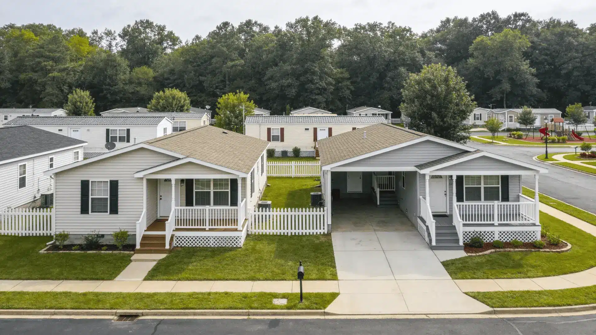
When an investor is looking at a buy-to-let flat or a commercial unit, the asset speaks for itself to a significant degree. They can visit it, understand the layout, assess the condition, and benchmark the opportunity against comparable properties with known rental histories.
Land offers none of this. A site boundary on an Ordnance Survey map tells you where the parcel is but not much about what surrounds it, how accessible it is, what constraints the topography creates, or what a finished development on that site might actually look like in context. Planning documentation adds useful information about permitted or likely use, but most investors aren’t trained to interpret these documents fluently — particularly those investing from overseas, where unfamiliarity with local planning processes adds another layer of uncertainty.
The result is a higher barrier to evaluation. Investors who might find a land opportunity genuinely attractive will often self-select out early, simply because they can’t get to a clear enough understanding of what they’re being asked to consider.
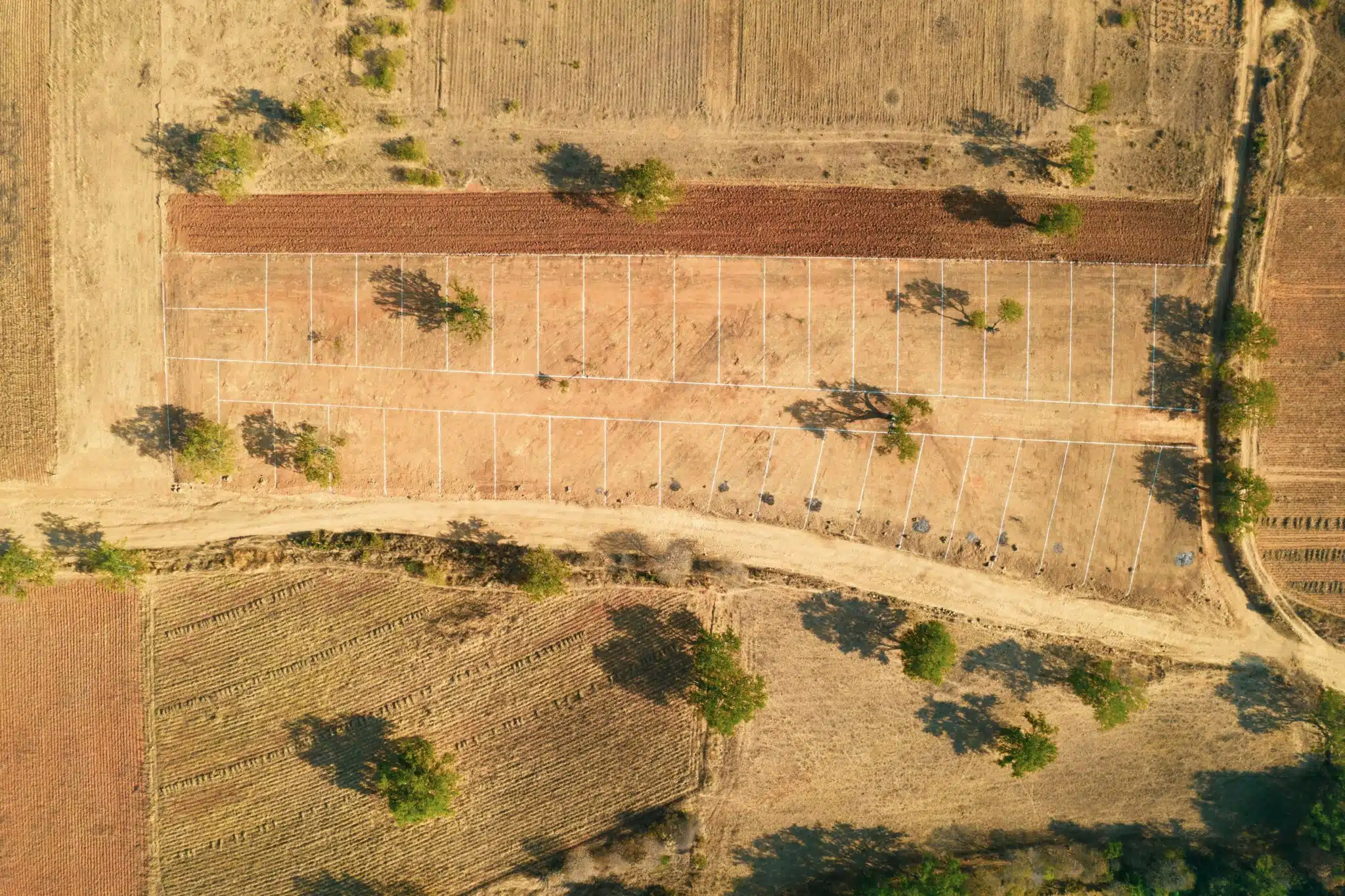
For larger parcels or development-led opportunities, an aerial rendering can help investors understand site boundaries, surrounding context, and future potential more quickly than flat documents alone. Rather than asking an investor to construct a mental picture of the site from maps and written descriptions, an aerial perspective shows them the parcel in its actual surroundings — neighbouring uses, road connections, nearby development, the physical scale of what they’re evaluating.
What Investors Need to See Before They Can Commit
Before any serious investor engages with a land opportunity at depth, they need answers to a fairly consistent set of questions. Getting those answers quickly, without requiring a site visit or an extended due diligence process, is what good site presentation enables.
Scale and boundaries.
How large is the parcel, and what does that mean in practical terms? A site described as 2 hectares reads very differently from seeing that footprint laid over an aerial view of the surrounding area. For investors unfamiliar with a specific location — which describes most overseas buyers and many UK investors looking at markets outside their home region — understanding scale in context is fundamental to forming any view of the opportunity.
Access and connectivity.
Land value is inseparable from access. A parcel that sits adjacent to a main arterial road reads differently from one where the access point is via an unmade track. Transport links — motorway junctions, rail stations, public transport routes — are significant value drivers that can be communicated quickly through a well-presented site overview but that are easily missed in a text-only description.
Surrounding context and growth drivers.
Is the site in or adjacent to a recognised regeneration area? Are there significant employer bases, infrastructure investments, or population growth projections that create underlying demand for whatever the site is most likely to support? These contextual factors often matter as much as the site itself, and they need to be made explicit rather than assumed.
Likely use and development logic.
The most important question for most investors is simple: what does this site become, and why? A site with outline planning for residential development is clearer than one with only a description of “mixed-use potential,” but even the former requires some explanation of how the development opportunity actually works in practice.
Turning a Parcel Into a Presentable Opportunity
Understanding the site is a prerequisite. Communicating it compellingly to investors is a separate task, and one that many landowners and agents underinvest in.
Much of learning how to sell land successfully comes down to presenting a parcel as an understandable opportunity rather than as an empty plot with unclear upside. That distinction matters practically: investors who are comparing multiple opportunities will prioritise the ones they can evaluate most quickly, all else being equal.
What that typically means in practice:
A clear narrative about the investment case.
Not just “the site has planning permission for 40 units” but “here’s why this site, in this location, at this stage of local development, represents a viable opportunity — and here’s what the exit looks like.” Investors who can follow the logic of an opportunity are more likely to engage seriously with it.
Honest representation of risk and upside.
Land investment inherently carries more uncertainty than developed property. Investors who understand this often accept it — but they need the key uncertainties to be named rather than glossed over. Planning risk, infrastructure requirements, timelines to development, likely exit routes — these need to be addressed, not avoided.
Materials that work for remote investors.
A significant proportion of UK land investment interest comes from buyers who won’t be visiting the site before making an initial decision. For this audience, the quality of the presentation materials is directly linked to the quality of the enquiries generated. A thorough site pack that includes clear visuals, planning context, connectivity information, and a concise investment case is materially more effective than a basic listing.
Where Better Presentation Makes the Biggest Difference
Large or complex sites.
A substantial parcel — anything where the footprint, topography, or relationship to neighbouring uses requires explanation — benefits significantly from visual treatment. Maps and plans alone simply don’t do the job.
Regeneration and growth areas.
Sites in areas undergoing significant change — where a new station, a major employer, or a regeneration masterplan is shifting land values — have a compelling story to tell. That story won’t reach investors unless it’s told explicitly.
Opportunities aimed at non-local or overseas investors.
For investors based outside a given market, the absence of local knowledge creates a barrier that presentation quality can partially compensate for. A well-prepared site pack that provides the context a local investor might take for granted becomes a prerequisite rather than a nice-to-have.
The Core Principle
Vacant land is harder to evaluate than built property, but not impossible to present well. The investors who pass on land opportunities most often aren’t passing because the opportunity is poor — they’re passing because they couldn’t quickly get to a clear enough view of what the opportunity actually is.
Addressing that clarity problem, through better visual presentation and a more explicit investment case, is the most direct way to improve the quality and quantity of serious interest in any land opportunity.